Wildfire
FireScore, thermal activity, fire growth monitoring, asset exposure, and day-ahead FireOutlook.

EARTH DATA | AI | INFORMED DECISIONS | A SAFER TOMORROW
ARTH transforms geostationary satellite radiances into ~250–450 m multispectral observations every five minutes, delivering a continuously refreshed physical-state data layer for climate, weather, infrastructure, and risk decisions.
Our mission is to close environmental blind spots so communities, businesses, and public agencies can protect lives, livelihoods, assets, and ecosystems.
FireScore, thermal activity, fire growth monitoring, asset exposure, and day-ahead FireOutlook.
Vegetation health, soil moisture, drought severity, and fuel conditions.
Water extent, flood duration, and surface-water dynamics for response and planning.
Plume awareness, downwind population exposure, PM2.5 context, and advisory support.
Crop and heat stress, irrigation intelligence, planting windows, and extreme-weather response.
Neighborhood heat exposure, infrastructure risk, and resilience planning.
Roadmap: smoke and vegetation next; other domains require customer evaluation and validation. Outlook expansion target: up to 15 days.
Late information leaves exposed communities and businesses making reactive decisions.
Global natural-disaster losses in 2024
Munich ReInsured portion of 2024 disaster losses
Munich ReUninsured share of those losses
Calculated: ($320B − $140B) / $320BU.S. crop and rangeland losses in 2024
AFBF · weather and fireAnnual disaster costs including cascading and ecosystem effects
UNDRR · GAR 2025California IOU wildfire-related costs estimated for 2024
CPUC · mitigation and insuranceThese figures describe different loss and spending categories.
| System | Spatial measure | Refresh / revisit | Role and tradeoff |
|---|---|---|---|
| LEO / VIIRS in FIRMS | 375 m imagery | ~2 passes/day per satellite | Fine detail; observation gaps between passes |
| GEO / GOES ABI · NGFS | 2 km fire-channel pixels | Every 5 min · CONUS | Frequent coverage; coarse thermal pixels |
| OroraTech | 200 m thermal imagery | Orbit-dependent; ~30 min constellation target | Own satellites plus public-source data |
| FireSat | 80 m imagery; 5 × 5 m fire detection | ≥2/day initial service; ≤1 hr target by 2029 | Revisit improves with constellation buildout |
| First Street / Cotality (CoreLogic) | Modeled property-level risk | Model and scenario updates | Risk assessment, rather than observation cadence |
| ARTH / FLARE | ~250–450 m reconstructed grids | Every 5 min | Fine-grid radiance at GEO observation cadence |
Image resolution, minimum detectable fire size, and reconstructed grid spacing are different measures. Revisit varies with location and mission phase; targets are labeled.
Sources: NASA VIIRS · NASA FIRMS · NOAA ABI · OroraTech sensor · revisit target · FireSat · First Street · Cotality
ARTH builds on existing satellites. No new orbital hardware is required.
Public GEO inputs, with five-minute CONUS observations and cloud-accessible archives.
Physics-aware reconstruction designed to retain spectral relationships.
~250–450 m reconstructed observations, refreshed every five minutes.
Radiance feeds brightness-temperature layers, FireScore, and inputs for customer models.
Package current and historical observations for API access and COG / Zarr workflows.


Inspect thermal activity and FireScore to identify locations that need closer attention.
Compare spatial detail ↗
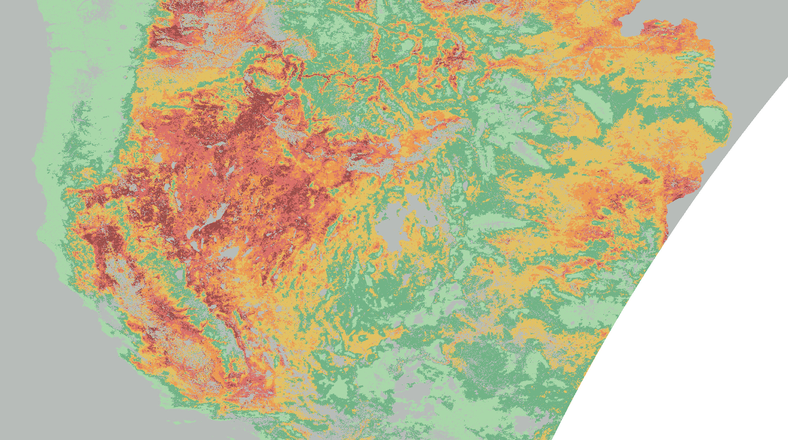
Landscape contextUse day-ahead FireOutlook to prioritize areas for monitoring and preparedness.
Explore the full story ↗
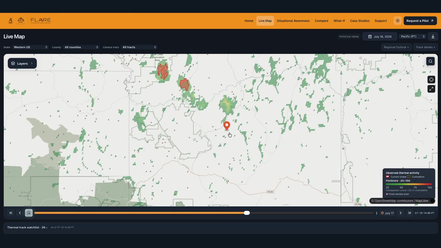
Regional monitoring and replayReplay FireTrack observations and assess changing activity around customer locations.
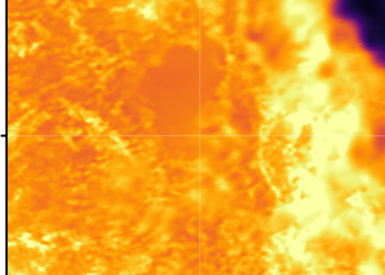
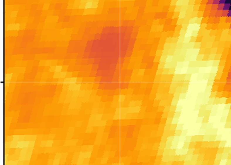
Watch the dashboard demo ↗Thermal pair: same region and time; approximate spectral pairing and shared display range. FireTrack represents thermal activity, not a surveyed perimeter.

Preparedness and response
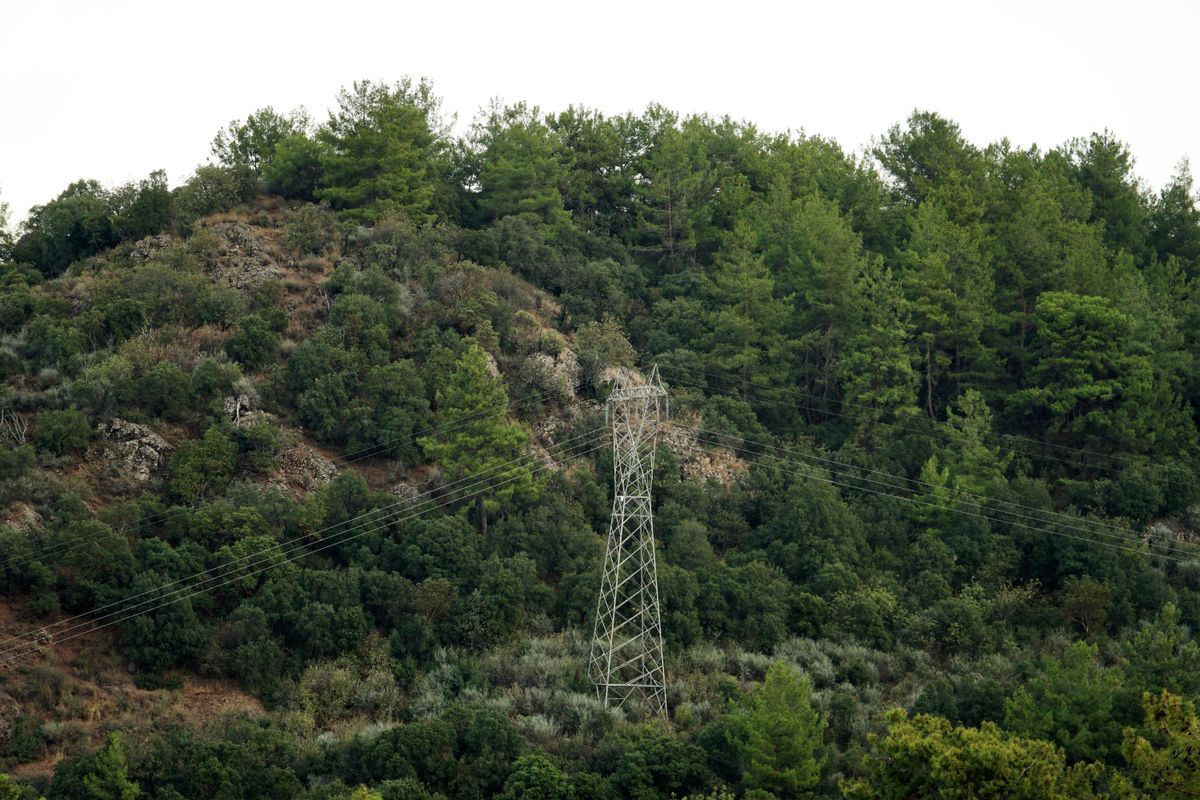
Asset and network monitoring
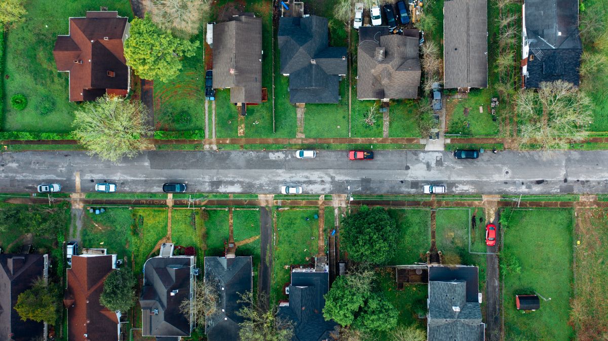
Exposure and event analysis
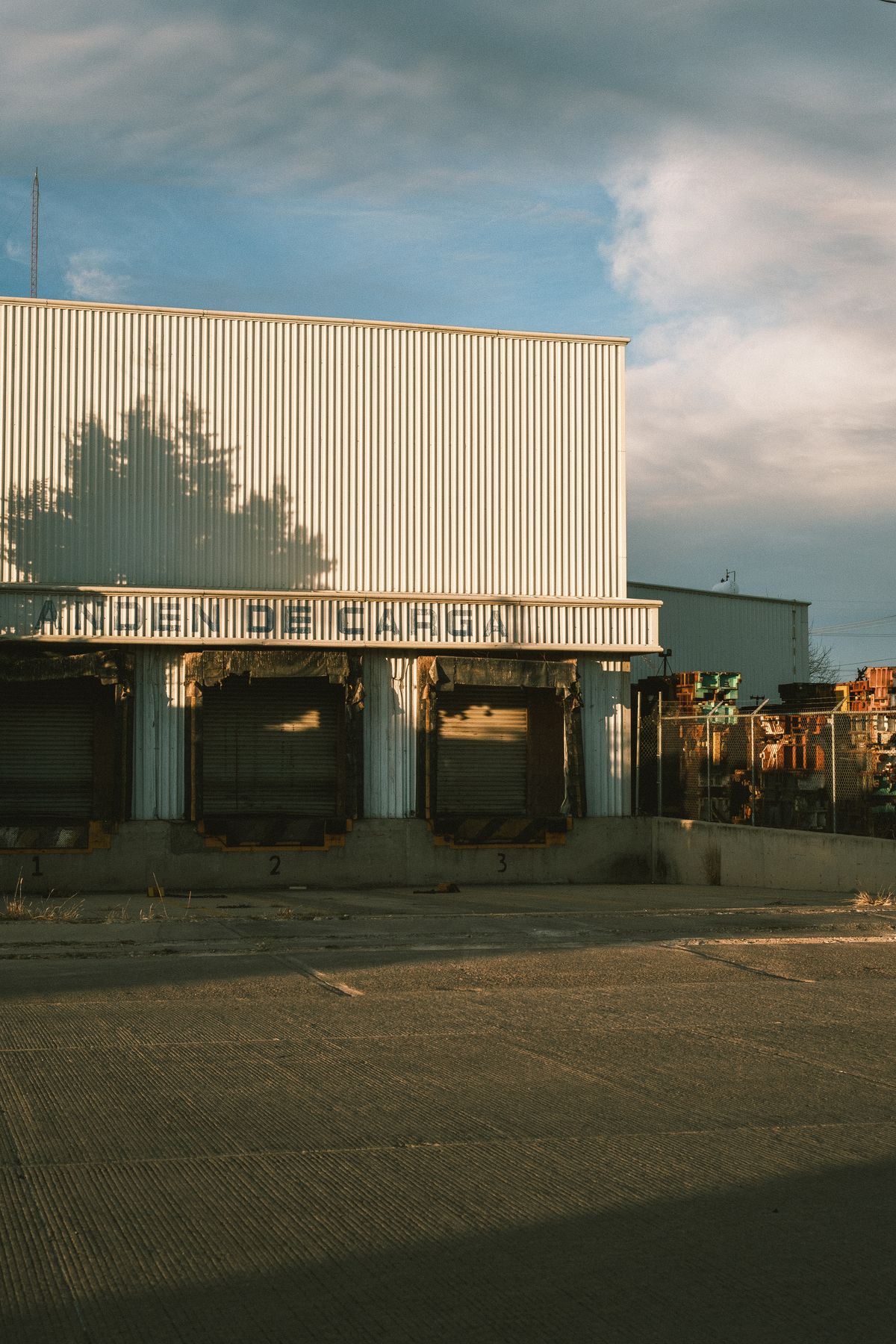
Operational continuity
Observe and anticipate: thermal reconstructions, FireScore, and day-ahead FireOutlook.
Assess and review: FireTrack replay, regional summaries, and dated reference observations.
Integrate: radiance, fire-monitoring data, and historical records for customer systems.
A data quotation prepared and sent at UTRGV’s request.
Quotation only; no agreement or revenue booked. Rate card and calculation ↗
Conversion of customer evaluations into annual data subscriptions or application contracts.
The team brings atmospheric-science and remote-sensing AI experience, including prior GEO AI work deployed in EPA/NOAA systems.
Reconstructed imagery, FireScore, FireOutlook, and FireTrack replay are brought together in the demonstrated product workflow.
Dated thermal observations and incident replay provide a basis for evaluating performance across events and conditions.
Reconstructed radiance, derived layers, and historical archives for customer models, delivered through API, COG, and Zarr.
Tailored dashboards, alerts, reports, and workflows for teams that need operational decision support.
Custom environmental investigations: dredging and fisheries, agricultural heat stress, and scientific risk assessments.
Observation-constrained forecasts for fire risk, smoke arrival, crop heat stress, and flood persistence.
Commercial model and proposed pricing.

Commercial strategy and institutional engagement

Atmospheric science and geospatial AI
A 12–18 month operating plan covering product validation, data delivery, and customer acquisition.
Target: 2–3 paid deployments, followed by annual-contract conversion.
Talk to the founders ↗msmriti@bridgerpf.org
cso@bridgerpf.org
| 30%SALES & GTM | Customer evaluations → paid deployments. |
| 30%ENGINEERING & SCIENCE | Reproducible benchmarks → stronger product evidence. |
| 25%INFRASTRUCTURE | Measured reliability → repeatable data delivery. |
| 15%OPERATIONS & LEGAL | Contracts and operating readiness → supported annual accounts. |
Proposed use of funds · 12–18 month operating plan
| Layer | Credits / tile |
|---|---|
| Shortwave radiance · I01–I03 | 0.5 |
| Thermal radiance · I04–I05 | 1 |
| Brightness temperature · BT04/05 | 1 |
| FireScore (2026 rate card) | 1 |
| Full bundle · RGB included | 2.5 |
Original 2026 rate card · 440 × 440 pixel tiles · Zarr / COG delivery
$0.025 / credit · qualifying nonprofit
$0.05 / credit · corporate
At $0.025 per credit, this total corresponds to 2,010,420 annual credits.
Credit volume is inferred from the quoted total and nonprofit rate. The original appendix does not itemize UTRGV’s geography, layer mix, or delivery count.
Full bundle: 2.5 credits × rate = $0.0625 nonprofit or $0.125 corporate per tile delivery.