ARTH
Real-Time Earth Observation · GeoAI

Climate risk
is real-time.
The intelligence
layer should be too.

Satellite radiance at 250–400m, refreshed every 5 minutes across CONUS. Powered by physics-aware GeoAI. FLARE is our first product — wildfire intelligence — released March 14, 2026.
ARTH GEO INTELLIGENCE…towards tomorrow
01Wildfire
02Drought & Vegetation
03Flood & Water
04Smoke & Air Quality
05Agriculture
06Urban Heat
Mission

Earth observation & GeoAI
for people, places, and livelihoods.

Our mission is to close the environmental blind spots that leave communities, businesses, and public agencies reacting too late. Through neighborhood-scale Earth observation and customized geospatial AI, we help decision-makers protect lives, livelihoods, assets, and ecosystems before risk becomes crisis.

🔥
Wildfire
Real-time fire detection and spread tracking. FireScore, perimeter, asset exposure, 15-day outlook.
🌵
Drought & Vegetation
Vegetation health, soil moisture, drought severity, and fuel-load monitoring across CONUS.
🌊
Flood & Water
Water extent, flood duration, and surface-water dynamics for emergency response and planning.
💨
Smoke & Air Quality
Smoke plume awareness, downwind population exposure, PM2.5 context, and advisory support.
🌾
Agriculture
Crop stress, heat stress, irrigation intelligence, planting windows, and extreme-weather response.
🌡️
Urban Heat
Neighborhood-scale heat, exposure, infrastructure risk, and resilience planning.
Why Now · The Stakes

When the data is late,
decisions become reactive.

Six sectors depend on timely environmental intelligence to protect lives, assets, and ecosystems.

$320B
Total economic disaster losses, 2024
Munich Re
$140B
Global insured losses, 2024
Swiss Re · 2024
57%
Of 2024 losses were uninsured
Protection gap
$20.3B
US crop losses from weather, 2024
AFBF 2025
$2.3T
Annual disaster costs, cascading
UNDRR 2025
$6B/yr
CA IOU wildfire mitigation spend
IOUs · 2024–25
Public agencies
Emergency management, wildfire response, evacuation, smoke advisories, infrastructure resilience.
Insurance / Reinsurance
Dynamic exposure, claims operations, underwriting support, event replay, risk score defensibility.
Utilities & Infrastructure
Asset exposure, fire proximity, line corridors, pipelines, power grid, situational awareness.
Agriculture
Heat stress, drought, crop losses, irrigation, planting windows, agricultural burning context.
Researchers
High-frequency physical measurements that enable new science and model development.
Climate intelligence
A data layer for next-generation GeoAI models, agents, apps, and risk products.
The Problem

Every system forces a choice:
resolution or refresh rate.

The satellite stack forces a tradeoff every operator knows but nobody has solved — until now.

System Resolution Refresh Rate Key Gap
LEO / FIRMS 375m 6–8 passes/day Polar-orbit blind windows
GEO native / NGFS 2,000m Every 5 min Coarse native pixels
OroraTech 4m ~30 min target New constellation, not continuous
FireSat 80m GSD / 5m hotspot 2×/day Phase 1 Full refresh rate requires future constellation
First Street / CoreLogic Modeled / parcel-level Annual Risk score, not event-time detection
FLARE / ARTH 250–400m Every 5 min Near-LEO detail at GEO refresh rate
Geostationary Earth Orbit (GEO)
2 km
GEO RGB over Huntsville, Alabama
ARTH
250–400m
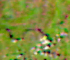
ARTH synthetic radiance over Huntsville, Alabama
Huntsville, Alabama
How It Works

ARTH creates the missing layer.

GEO sees often. LEO sees clearly. ARTH combines both — no new hardware required.

01
Geostationary Earth Orbit
Geostationary. 5-minute refresh rate. Continuous CONUS. Public data on AWS.
02
ARTH GeoAI
Physics-aware AI. Preserves spectral integrity.
03
LEO-like Data Products
250–400m. Every 5 min. Analysis-ready data.
04
Domain Models
Fire · Flood · Drought · Agri · Air Quality · Heat. One engine, six domains.
05
Decision-Ready
API · COG · Zarr · Dashboards · Alerts · Event replay.
250–400m
Spatial Resolution
5 min
Refresh Rate
65M+
Pixels / layer / scan
6
Climate Domains
Science drives the AI. Data becomes intelligence.
Why Now

The convergence moment for
GeoAI-driven climate intelligence.

Satellite streams GEO · 5-min · CONUS GeoAI breakthroughs Physics-aware models Real-time demand Insurers · utilities · ag ARTH RADIANCE LAYER
01
Geostationary Earth Orbit (GEO) fully operational
Continuous 5-minute CONUS coverage on public AWS infrastructure. No tasking. No revisit gaps. The substrate finally exists.
02
Physics-aware GeoAI matured
Physics-aware AI constrained by atmospheric, combustion, and surface physics — preserves calibration. Statistical generation isn't enough; this is.
03
Regulatory forcing function
Washington SB 5928 mandates factor-level wildfire score attribution. CA IOUs filing $6B/year mitigation plans. ERCOT issued 6 wildfire control notices in March 2025 alone.
04
$5B+ wildfire cat bonds in 2025
Capital markets pricing dynamic risk. The buyers are forming the budgets right now — not in 2028.
Business Model

One data layer.
Four revenue streams.

They have modelers. We provide the missing observation layer. Each new domain expands all four lines simultaneously.

01
Data-as-a-Service
Raw LEO-like radiance, derived layers, and archive via API. For organizations with in-house modelers, scientists, or GIS teams.
Cat modelers · Reinsurers · Insurance analytics · Utilities
Pipeline operators · Researchers · Government agencies
$0.025–$0.05 / credit · API · COG · Zarr
02
Solution-as-a-Service
Tailored dashboards, alerts, workflows. For teams that need decisions, not raw radiance.
Counties · Cities · Small utilities · Regional insurers
Agriculture groups · Emergency offices · NGOs
$25K–$250K / year · Complexity-based
03
Scientific Consulting
Custom environmental investigations. A senator asking about dredging and fisheries. A farmer asking when heat stress peaks today.
Legislators · Agencies · Legal teams · Farmers
Foundations · Resilience programs · Environmental groups
$10K–$500K / project · High margin
04
Forecast Intelligence
Observation-constrained near-term forecasts. Fire probability, smoke arrival, crop heat stress, flood persistence.
Agriculture · Insurance · Utilities · Emergency management
Infrastructure operators · Asset managers
Premium subscription · Observation is the moat
Product Portfolio

FLARE proves the engine.
The platform unlocks five more.

FLARE · Wildfire Intelligence

The first product proof.

FLARE turns the ARTH radiance engine into operational wildfire intelligence — FireScore, hotspot detection, perimeter tracking, smoke awareness, and asset exposure at 5-minute refresh rate across full CONUS.

FireScore — composite fire detection score, 0–100
HotspotMask — pixel-level hotspot detection
Fire perimeter — growth tracking and spread rate
Smoke layer — awareness and plume extent
Asset exposure — infrastructure risk intelligence
Event replay — historical fire reconstruction
API + Dashboard — direct integration or managed access
Platform Expansion · Same Engine

Marginal cost per new domain is near zero.

Drought & Vegetation
NDVI · NBR · VHI · LST. 144× more frequent than MODIS.
Flood & Water
Water extent every 5 min. Flood duration. DNB outage detection.
Smoke & Air Quality
PM2.5 at 375m. Plume height. Built on deployed EPA/NOAA science.
Agriculture
Crop stress, phenology, parametric triggers, USDA NASS fusion.
Urban Heat
LST anomaly. Cooling inequality. Infrastructure heat-risk.
Market Opportunity

One data layer.
Many markets.

Core Platform
$114B → $226B
Geospatial Analytics · 11.3% CAGR
Earth Obs.
$5.1B → $7.2B
EO Market · 6.2% CAGR
Beachhead
$15.8B → $48B
Insurance Analytics · 15% CAGR
Cat Modeling
$2.85B → $6.9B
Catastrophe Modeling · 10.2% CAGR
Adaptation
$25.5B → $51B
Climate Adaptation · 10.5% CAGR
Consulting
$46.7B → $92.9B
Environmental Consulting · 7.95% CAGR
ARTH enters through Earth observation data licensing · expands into GeoAI analytics and climate adaptation · compounds into forecast intelligence.
Not claimed as direct TAM — adjacent market pools accessed through data licensing, tailored GeoAI, and forecast intelligence.
Validated Detections

Not projections.
Documented timestamps.

375m
PIXEL RESOLUTION · vs. 2km native GEO
Smokehouse Creek · TX · Feb 2024
GEO and ARTH both detected the thermal anomaly at the same moment. The difference is precision. Native GEO sees a 4 sq km box; ARTH resolves the same signal at 375m — a 28× spatial improvement that places ignition at asset scale instead of inside a neighborhood. Largest wildfire in Texas history: 1.06M acres, 2 fatalities, 500+ structures.
Asset-scale precision · Utilities · Pipeline
+3 hrs
EARLY DETECTION · before official confirmation
Talladega County · AL · Nov 2025
ARTH detected the thermal anomaly more than three hours before Alabama Forestry Commission official confirmation. Detection maintained through heavy smoke obscuring optical sensors. The Southeast is expanding high-risk territory and conventional reporting workflows lag behind the fire.
Early warning · P&C insurance · Emergency management
5 min
SPREAD & GROWTH · frame-by-frame tracking
Palisades / Eaton · CA · Jan 2025
ARTH tracked fire growth at 5-minute refresh rate from initial ignition through full perimeter expansion. Registered first thermal signature at ~10 acres at 10:31 AM and documented 100× growth over the next 4 hours through continuous observation. Dual-event discrimination across fires 30+ miles apart. Costliest wildfire event in recorded history.
Continuous monitoring · CA utilities · Reinsurers
Traction

Post-product. Pre-seed.
Built and validated.

Completed ✓
✓
FLARE FireScore v2 released — 250–400m · 5-min · full CONUS · March 14, 2026
✓
Validated: Smokehouse Creek TX 375m · Talladega AL +3 hrs · Palisades CA 5-min tracking
✓
101 active platform users · 850+ events · organic · zero paid acquisition
✓
UTRGV data agreement — $50K/yr · 3-year · contingent on EPA grant
✓
CSO's GEO AI deployed at US-EPA AirNow and NOAA — production today
✓
API released — Zarr / COG / GeoTIFF delivery available today
✓
BRIDGE Research Foundation 501c3 — nonprofit scientific incubator
Now · Q2 2026
Radiance layer (I01–I05, BT04, BT05)
FLARE wildfire intelligence
FireScore v2 and HotspotMask
FLARE RGB and event replay
Data API (Zarr, COG, GeoTIFF)
Near-Term · Q3–Q4 2026
Asset exposure layer
Crop stress product
Flood duration monitoring
Smoke movement & plume awareness
County wildfire dashboards
First paid pilots close · seed-ready
Roadmap · 2027
PM2.5 estimation & plume height
Advanced drought indices
Fire Radiative Power (FRP)
M-band expansion
Forecast intelligence (fire, smoke, crop)
The Team

Founder-led.
Science-first.

Public policy and scientific rigor — built to earn the trust of governments and enterprise.

Manju Smriti
MS
Manju Smriti, MPA
CEO · Co-Founder
Public policy strategist bridging research, technology, and climate action. MPA, Cornell Brooks School of Public Policy. MA Philosophy, JNU. Prior: Cornell Global Operations, United Nations DPPA, US Government Accountability Office. Founded BRIDGE Research and ARTH Geo Intelligence to turn rigorous Earth science into operational tools.
Public Policy
Operations
Climate action
Stakeholder Engagement
Alqamah Sayeed
AS
Alqamah Sayeed, PhD
Chief Science Officer · Co-Founder
Atmospheric scientist and remote sensing AI lead. NASA EarthRISE Science Lead for Air Quality & Health. Built operational GEO AI systems used by US-EPA AirNow and NOAA. Leads the core physics-aware AI, radiance generation, FireScore, and FLARE architecture.
Remote sensing
Physics-aware AI
Wildfire
Atmospheric Science
The Ask
Raising

$500K

Pre-Seed · YC Post-Money SAFE
Platform is shipping. $500K converts technical proof into first paying customers, seed readiness, and domain expansion. 12–18 month runway.
30%
Sales and GTM
30%
Team — Engineering and science
25%
Cloud and infrastructure
15%
Operations and legal
18-Month Milestones
1
Close 2–3 paid pilots
2
Qualify 10+ enterprise accounts
3
Convert pilots into annual contracts with $130K+ ARR in year one
4
Launch ARTH radiance API and publish validation benchmarks
5
Expand beyond wildfire into a second commercial domain
ARTH
ARTH Geo Intelligence
ARTH Geo Intelligence…towards tomorrow

Climate risk is real-time.

Your intelligence should be too.

Wildfire · Flood · Drought · Agriculture · Air Quality · Urban Heat
Reference Material

Appendix

A · Technical Validation
B · Radiance, Not Imagery
C · FLARE Rate Card 2026
D · Competitive Detail
E · Investor Q&A
F · Sources
Appendix A · Technical Validation

How we know it works.

A 5-step validation pipeline grounded in collocated LEO observations as ground truth.

01
Geostationary Earth Orbit (GEO) input
Geostationary Earth Orbit (GEO) observations serve as the primary high-refresh rate input — 5-minute refresh, continuous CONUS coverage. Public data on AWS.
02
Collocated LEO observations
Collocated LEO observations establish ground truth. LEO provides the high-resolution, calibrated reference signal at 375m.
03
Physics-aware model output
ARTH generates LEO-like radiance using physics-aware AI models driven by physical sciences. Preserves spectral integrity and calibration.
04
Independent validation
Spatial correlation, brightness temperature consistency, fire detection concordance, and event replay.
05
Operational deployment
FLARE FireScore, radiance APIs, Zarr/COG delivery, live web products, and customer-facing workflows.
Appendix B · Radiance, Not Imagery

This distinction defines
what ARTH's data can do.

ARTH does not produce pretty pictures of Earth. We produce calibrated, model-ingestible measurements of electromagnetic energy across specific channels — the same physical quantity LEO produces. That is why our outputs can drive scientific and operational decisions.

Imagery
  • RGB composites and visual satellite photographs
  • Designed for human interpretation
  • Not calibrated for quantitative analysis
  • Cannot be ingested directly by analytical models
Radiance — what ARTH produces
  • Calibrated, channel-specific electromagnetic measurement
  • Analysis-ready and model-ingestible
  • Powers fire detection, temperature retrieval, flood mapping
  • The data layer ARTH produces — LEO-like, 250–400m, every 5 min
Decision Intelligence — derived
  • Derived products built on radiance data
  • FireScore, HotspotMask, flood extent, crop stress
  • Translated from physics into operational outputs
  • What catastrophe modelers and reinsurers act on
Appendix C · FLARE Rate Card 2026

Pricing is published.
UTRGV was quoted at this rate.

Credit-based annual subscription · Tile: 440×440 px · ~350–400m pixel · 5-min refresh · Zarr / COG delivery
Layer Credits / tile Non-profit Corporate
Synthetic Radiance— I01, I02, I03 · Shortwave radiance 0.5 $0.025/credit $0.05/credit
Synthetic Radiance Thermal— I04, I05 · Mid/longwave radiance 1 $0.025/credit $0.05/credit
Brightness Temperature— BT04, BT05 · Brightness temp for I04/I05 1 $0.025/credit $0.05/credit
FireScore v2— Fire detection score 0–100 1 $0.025/credit $0.05/credit
FLARE RGB— I01–I05 · Fire-enhanced false color composite Included — —
Full Bundle— I01–I05, BT04/05, FireScore, FLARE RGB~17% saving 2.5 $0.0625/credit $0.125/credit
Credits are non-rollover per year. Over-usage billed at published rate. FLARE RGB included with any multi-layer subscription at no extra charge. Non-profit rate requires institutional verification. UTRGV: $50,260.50/year, 3-year term — proof of pricing.
Appendix D · Competitive Detail

Competitors own sensors,
models, or apps.
ARTH owns the layer.

ARTH fills the gap no existing system addresses: continuous fine-resolution radiance at 5-min refresh, CONUS-wide.

Dimension ARTH Geo Intelligence Public Satellites Commercial Constellations Risk / Cat Platforms
Examples
ARTH Geo Intelligence
FLARE · Radiance API · Solutions
GEO, LEO/FIRMS
MODIS, Landsat, Sentinel
OroraTech, FireSat
Planet, Maxar
First Street, CoreLogic
Moody's RMS, Verisk/AIR
Strengths ✓Real-time GeoAI radiance, 5-min refresh, CONUS-wide, ignition-scale detection ✓Broad coverage, free access, scientific credibility ✓Strong sensor hardware, growing coverage, sub-10m optical ✓Deep underwriting data, loss modeling, industry trust
Key Gap ✓None — fills the gap others cannot ✗Resolution-vs-refresh tradeoff; no fine detail at 5-min refresh rate ✗Limited revisit time; cannot monitor continuously at scale ✗Periodic assessment only; not built for real-time events
ARTH Position
250–400m · 5 min
CONUS-wide · ignition-scale
↑ ARTH adds fine resolution + continuous refresh rate on top of public infrastructure
↑ ARTH enables persistent wide-area coverage; complementary, not competitive
↑ ARTH is a data input; cat platforms are potential customers
Appendix E · Investor Q&A

The hardest questions,
answered upfront.

Is this real radiance, or AI-generated imagery?
Calibrated, analysis-ready radiance — not visual imagery. Outputs are channel-specific electromagnetic measurements validated against collocated LEO observations using spatial correlation, brightness temperature consistency, and fire detection concordance. Suitable for scientific and operational use.
Why can't NASA, NOAA, or Google do this?
Public systems do not produce continuous high-resolution radiance at 5-minute refresh rate. They publish raw sensor outputs. ARTH fills the specific technical gap between public infrastructure and commercial demand. Our CSO's GEO AI is already deployed at EPA AirNow and NOAA — we know the system from the inside.
What makes this defensible?
Three layers of moat. A proprietary physics-aware GeoAI grounded in collocated GEO and LEO observations. The growing data archive and validation history. Domain models for fire, flood, drought, agriculture, smoke, and heat — built on a decade of deployed federal science. The sensor is not the moat. The science is.
How does this become a large company?
Each new application expands TAM without rebuilding the core. Wildfire today, flood and drought next, then air quality, agriculture, and urban heat. Platform scales horizontally across markets and vertically through solution depth. Marginal cost per new domain is near zero.
Why $500K? Why pre-seed?
Platform is shipping. $500K converts technical proof into paid customers. 12–18 month runway. First 2–3 paid pilots, validation benchmarks published, second commercial domain launched, seed-ready by Q4 2026. The window — GEO coverage, GeoAI maturity, climate-driven demand — is open right now.
What about CSO transition to full-time?
Alqamah transitions from NASA SERVIR Thematic Lead to full-time CSO upon close of round. His current part-time engagement has produced FLARE, the radiance pipeline, and the EPA/NOAA-deployed PM2.5 model. Full-time post-funding accelerates domain expansion across the platform.
Appendix F · Sources

All numbers sourced.
No inflation. No claim to TAM.

All market numbers are sourced from third-party research and used as stated. ARTH does not claim all cited markets as direct TAM — these are adjacent market pools illustrating addressable demand across our four revenue lines.

Market Sizing

  • Grand View Research — Geospatial Analytics Market, 2025–2030
  • Grand View Research — Earth Observation Market, 2025–2030
  • Reuters / Novaspace — Global Earth Observation Market, 2024
  • Grand View Research — Insurance Analytics Market, 2026–2033
  • Grand View Research Horizon — U.S. Insurance Analytics Market, 2026–2033
  • DataIntelo — Catastrophe Modeling Market Research Report, 2025–2033
  • Grand View Research — Climate Adaptation Market, 2024–2030
  • Precedence Research — Environmental Consulting Services Market, 2025–2034
  • Grand View Research — Weather Forecasting Services Market, 2026–2033
  • Carta — Pre-seed SAFE data (instrument context)

Loss & Validation

  • Munich Re — 2024 disaster loss totals: $320B economic
  • Swiss Re Institute — 2024 insured losses: $140B · 5th consecutive $100B+ year
  • UNDRR — 2025 Annual disaster cost framework: $2.3T cascading
  • AFBF — 2025 US Crop Loss Report: $20.3B weather, $11B drought + heat
  • InciWeb · USFS — Smokehouse Creek Fire timeline (Feb 2024)
  • Alabama Forestry Commission — Talladega County wildfire reporting (Nov 2025)
  • CAL FIRE / LAFD — Palisades / Eaton Fire incident timeline (Jan 2025)
  • CPUC — Investor-Owned Utility Wildfire Mitigation Plans, 2024–2025
  • WA Legislature — SB 5928 (factor-level wildfire score attribution)